


Thank you for using this forecast. Like it? Find it useful? Support it (and me!) by sending some cash my way. What’s it cost to support me and get the email version? Not $99 a year. Nope. Not $49. Just $19.99 or more gets you a year. People are added to this list on Thursday and Sunday. My day job is crisis mental health, and I don’t have time on other days. Thanks for your patience! Click below to contribute. Thank you!!
 |
|
 |
Thank you for contributing and keeping this forecast going! Not ready to subscribe? No problem – please share this forecast with all your friends too! I appreciate your support!
The Forecast
| Snow level | 4a-8a | 8a-12p | 12p-4p | 4p-8p | 8p-4a |
|---|---|---|---|---|---|
| Saturday 1000′->0′ |
 |
|
|
|
|
| Sunday 0′->4000′ |
 |
 |
 |
|
 |
| Monday 4000′->8000′->6500′ |
|
 |
|
|
 |
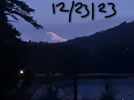
Mt. Hood Snow Forecast
Mt. Hood picked up about 4” of snow in the last 24 hours, and that’s going to make for an awesome day on the slopes today. At least, it’ll be as awesome as it’s been so far this year. Get it now, because there’s rain in the forecast this upcoming week.
Expect a sunny day, all day, on Saturday. The free air freezing level (FAF) will be 1000′ this morning, 1500′ this afternoon, and down to 0′ overnight. No precip. Wind will be light westerly early becoming E 10-15 this afternoon and turning to W 10-20 overnight.
High clouds on Sunday morning thicken and lower in the afternoon and add a bit of snowfall. The snow level will be 0′ ish in the morning with 850mb (5000′) temps right near freezing. The snow level rises to 2500′ in the afternoon and 4000′ overnight. Just a trace of snow is forecast during the day. 0.1” to 0.2” water equivalent (WE) is forecast overnight. Temps will start to rise after midnight, so it’s possible we’ll see a switch to mixed precip after midnight. Up to 2” new snow is possible. Wind: S 10-20 in the morning, SW 10-20 in the afternoon, and SW 15-30 overnight.
Monday starts with snow or mixed precip and quickly switches to mixed precip then rain. The snow level will be 4000-5500′ early and will quickly rise to 8000′. It drops to 6500′ overnight. About 0.8” WE is forecast during the day. That’ll mostly be rain. Overnight, just a trace is forecast. Wind: SW 15-25 in the morning becoming SW 20-35 in the afternoon and falling to SW 10-20 overnight.
Looking deeper into the future: models suggest some snow will fall on Wednesday. After that, the main models diverge. The GFS keeps us just cold enough for snow. The Euro is a touch warmer. We’ll have to wait a bit and see how things shake out. Looking at the percentiles for snow through the end of the year, the 50th percentile is about 11”. The 90th is about 20”. Vote, as always when we’re talking snow, for the 90th percentile. Have a great day on the slopes today. Should be a fun one!
Gorge Wind Forecast
 Hi friends! Sounds like some of you got the goods yesterday. Thanks for doing that while team SUP Foil Super-Spreaders is in recovery mode. All we have for you the next six days is a whole bunch of easterlies with colder temps. Saturday starts with W 5-10, turns calm mid-morning, and sees easterlies build to 20-25 from Iwash (Rooster) Rock to Stevenson this afternoon. River flow yesterday was 106-144kcfs, river temp is 46F, and high temp forecast is 40F under sunny sky.
Sunday starts with E 40-45 at Iwash and 25-30 at Stevenson. The wind falls to 25ish both locations early afternoon and drops to 20mph late afternoon. High temp: 37F under mostly cloudy sky. Monday will have rain in the windy zone and (probably) freezing rain near Hood River. Easterlies will be 30-35 in the morning from Iwash to Stevenson. They’ll rise to 40mph at Iwash in the afternoon. High temp: mid to upper 30’s and wet. Or icy. Easterlies bounce around Tuesday through Thursday, and models suggest a more consistent day next Friday, but that’s way too far out to be reliable. Enjoy!

| FORECAST SPONSORED BY / AWESOME COMPANIES TO SUPPORT | |
 |
|
Jones, Sauvie’s, Coast – On vacation ‘til summer unless otherwise noted
Hood River Weather Forecast
Partly cloudy sky this morning gives way to full-on sun. Temps start near 40 and stay right there. Light westerlies early become light easterly later. No rainbows. Sunday will be partly Nothing with high clouds in the morning. Rain or freezing rain or snow arrives after midnight. Temps will be in the low 30’s early and mid-upper 30’s later. Easterlies. Nor rainbows. Monday (Christmas) starts with freezing rain and finishes with rain, mostly likely. Temps start in the upper 20’s and rise to the mid-upper 30’s. Easterlies. No rainbows.
Looking for a complete Columbia Gorge forecast? Looking for more humor in your weather? Obscenities? You’re looking for my TATAS: Temira’s Awesome Travel Advisory Service on Facebook.
Local-ish Events
Please let me know of outdoor-related local-ish events. If you don’t tell me, I don’t know!
Teacup has an après ski fundraiser at the Ruins on January 27th. $25. Amayah’s Indian Cafe (Biggs) offers a free meal every first Thursday from 1-4pm.
Regular weekly events:. NK Studio’s by-donation Tuesday morning yoga class is back. Ferment’s Tuesday night 4-mile walk/run is at 6pm. There’s meditation with monks at 5:15pm (an hour) and 6:30pm (30 minutes plus a talk) at Yoga Samadhi in White Salmon. The Tri Club is done for the season. At 7:15am on Wednesdays, there’s a run from the White Salmon Bakery. At 7am on Friday morning, there’s a run from Pine Street Bakery. On Fridays at 2:30pm, there’s a free meditation and stretching class at Yoga Samadhi. On Saturday at 9am, there’s a by-donation outdoor group fitness on the 2rd floor deck about Ferment Brewing.
Cycling
Regarding the trails in general: don’t ride in the mud. You’ll damage the trails. Don’t ride trails if it was below freezing the previous night and is above freezing when you want to ride. Ride gravel. Ride your trainer. Build trails. There are trail builders seeking extra hands on seven additional miles of trail on Whoopdee. Contact HRATS for more information. If you’re parking at Post Canyon, you will need a parking pass. Those can be purchased at many local shops or online.
Sprinter Van of the Week!
 Click here for the Sprinter Van map of the world!!!
Have an awesome day!
PREVIOUS POSTS
- Saturday Mt Hood snow forecast & Gorge wind n’ weather: finally, winter arrives for Mt Hood. West wind day possible for the Gorge Monday. Snow possible Thursday!
- Friday Mt Hood snow forecast & Gorge wind n’ weather: finally, a pattern change that’ll bring snow to Mt Hood!
- Thursday Mt Hood snow forecast & Gorge wind n’ weather: finally some real winter in the forecast!
- Tuesday-Wednesday Mt Hood snow forecast & Gorge wind n’ weather: dry and cool this week with lots of sun. Snow for Mt Hood starting Friday!
- Monday Mt Hood snow forecast & Gorge wind n’ weather: mostly dry this week. Cooler and damper starting next Friday. Winter seems imminent…

Have an awesome day.
Love, Temira