


Thank you for using this forecast. I offer it freely so you can have more fun and plan your life. It does take significant time and energy to produce. If you find yourself using it often, or if you feel your life is more awesome because of my work, please make a donation. You can get this forecast via email by donation. The email subscription isn’t $99/year. Not $50/year. Donating $12.34 or more gets you on the list for 12 months. Thank you for your support and thank you for trusting my forecast.
Click here to donate using a credit card.
Click here to donate via PayPal.
Venmo: @theGorgeismyGym
Snail Mail: PO Box 841, Hood River, Oregon 97031
Get the email version free through the end of January – try it out! Click here.
| 4a-8a | 8a-12p | 12p-4p | 4p-8p | 8p-4a | |
|---|---|---|---|---|---|
| Friday 2500′->9000′->7000′ |
 |
|
|
 |
 |
| Saturday 7000′->1500′ |
 |
|
 |
 |
 |
| Sunday 1500′->0′ |
|
|
|
 |
 |
Mt. Hood Weather Forecast
The wild and decidedly uncooperative weather continues on Mt. Hood for the next couple of days. We start with the fact that the mountain received 2” of snow on Thursday night rather than a giant pile of powder. SAD! Light snow Friday day gives way to heavy rain on Friday evening. Saturday brings light rain, followed by sun, followed by snow. Sunday looks like the happy day with moderate to heavy snowfall and light wind. Monday’s shaping up to be an epic groomer day with sunshine, perfect packed powder, and cool temps.
Details for Friday: flurries during the day, heavy snow for a few hours in the afternoon, heavy rain overnight. The snow level will be 2500′ early, 5000′ around 4pm, 9000′ tonight, and 7000′ on Saturday morning. Daytime snowfall on Friday will be 0.2” water value (WV), for a couple inches of increasingly dense snow. After 4pm, the snow will switch to rain with about 2.0” of rain overnight. Wind will be WSW 30 early, SW 10 midday, building to SW 40+ overnight.
Saturday starts off with lingering showers and rainbows early with sunshine after sunrise. Clouds move in late afternoon and snow starts up around 10pm. Snow level: 7000′ early, 3500′ in the afternoon, 1500′ after midnight. About 1/4” rain will fall before sunrise. Evening precip measures up at 0.4” WV, for 4-5” of relatively dry snow. Wind will be SW 40+ early, WSW 25 in the afternoon, and S 10-15 overnight.
Sunday sees a system come in from the south. The current track keeps Mt. Hood in the cold sector of this system, for all-snow. The snow level will be 1500′ during the day and 1000′ or less after the bulk of the precip passes in the evening. About 0.5-0.7” WV falls during the day, for 5-8” of powder. A trace falls in the evening. Wind will be S 10-15 early, variable and light in the afternoon, and NE 10-15 overnight. Monday looks clear and sunny and cold. That means Rotary Night (a fundraiser for Hood River’s Rotary Club) will be awesome. https://www.skihood.com/schedule-events/january1/rotary-night
Gorge Wind Forecast
Friday starts out with light east flow in the west and light west flow in the east. Confusing! The wind will pick up to E 20-25 from Rooster to Stevenson this afternoon with E 5ish east of Mosier. Saturday starts out light and variable. In the afternoon, the western Gorge sees W 5-10 and areas east of Mosier see W 13-16. Sunday starts with E 15-20 near Stevenson and E 25-30 near Rooster Rock. The wind backs off to light easterly in the afternoon. Monday currently looks like W 12-15 in the west all day with light westerlies east of The Dalles.
JONES, SAUVIE’S, COAST: now on vacation for the fall and winter. Will return in spring.
Virtual Spin – video, beats, friends, BIKES!!
Got a schedule that makes it hard to link up with scheduled classes? No worries, we got you. Our virtual spin program gives you access to our all new Spin Studio built for our Cycling program. Connect up with Virtual Classes led by a live coach, or with voiceover some fresh beats and paired with Scenic Rides all over the world. You can even hit one button and play your favorites from NetFlix and a variety of other media services. Or jam out to tunes and catch up with your friends for an all-time great experience in a private studio. Bike Max is 10 people. Meet up with your friends on your schedule and keep your cycling fitness strong all winter long!Get signed up now by clicking here!
Hood River Weather Forecast
Showery weather on Friday morning gives way to heavy rain mid afternoon and overnight. Temps will be in the mid 30’s early and mid 40’s later. East wind. 16% chance of rainbows. Saturday looks sprinkly early, Nothing midday, and rainy overnight. Temps will be in the low 40’s early and upper 40’s in the afternoon. Light west wind. 92% chance of rainbows. Sunday looks wet, likely snow mixed with rain. Temps will probably not reach the computer modeled high of 46. Rather, it’ll be in the 30’s all day. East wind. No rainbows. Icy roads look likely late Sunday into Monday.
For weather specifically directed at travel through the Gorge, please visit Temira’s Awesome Travel Advisory Service on Facebook.
White Sprinter Van of the Week!
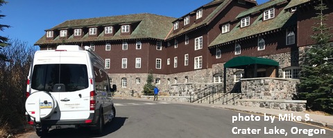
Click here for the White Sprinter Van map of the world!!!
Road and Mountain Biking
It’s Friday morning, and it’s quite wet out there. Best bet? Gym bike! Ha.
Upcoming Events
At 7am on Friday, there’s the Kickstand Coffee Run, where jogging or walking 4 miles gets you a free cup of coffee and a donut. There’s a by-donation yoga class at Yoga Samadhi at 4:15 on Friday afternoons. Tonight, Friday, from 6-8pm, the HRVHS Nordic team has a fundraiser at Kickstand Coffee. Come support these amazing kid-athletes!
Random Morning Thoughts
Click here for the full events calendar.
Have an awesome day today!
Temira
