Get the email free through the end of March – try it out! Click here.
Thank you for using this forecast. I offer it freely so you can have more fun and plan your life. It does take significant time and energy to produce. If you find yourself using it often, or if you feel your life is enhanced by this information, please make a donation. Click right here to donate. I count on your support to pay my bills, and am deeply grateful to you for choosing to help support me. You can get this forecast via email by donation. The email subscription isn’t $99/year. Not $50/year. Donating $12.34 or more gets you on the list for 12 months. Don’t PayPal? Send a check to Temira @ PO Box 841 in Hood River. Thank you for your support and thank you for trusting my forecast.
| 4a-8a | 8a-12p | 12p-4p | 4p-8p | 8p-4a | |
|---|---|---|---|---|---|
| Wednesday 5000′->6000′ |
 |
 |
 |
 |
 |
| Thursday 5500′->7500′ |
 |
 |
 |
 |
 |
| Friday 7000′-12,000′ |
 |
 |
 |
 |
 |
Mt. Hood Snow Forecast
It’s Wednesday morning, and the models are finally coming into agreement about what will happen through the weekend. The general picture is that we’ll see light to moderate rain on the mountain from midday today on through Saturday morning, after which heavy snow will fall through Sunday. Looking longer range, the models agree on dry and warm weather Monday and Tuesday with more progressive weather after that. The Euro brings heavier snowfall amounts for the latter half of next week. Definitely worth keeping an eye on that!
For Wednesday, the mountain will receive light snow early followed by light rain. The snow level will be 5000′ early and will rise to 6000′ by mid-morning. About .2” water value (WV) falls as snow that switches to rain. Less than 1/10” additional rain falls overnight. Wind will be W 25 early, W 30 in the afternoon, and S 15 after midnight.
Thursday looks rainy, although we could see periods of wet snow, snain, or mixed precipitation in the morning. The snow level will be 5000′-6000′ early and 7500′ from the afternoon on. Wind will be S 15 early, WSW 35 midday, and WSW 20 after midnight.
Friday looks rainy. The snow level will start around 7000′, rise to 12,000′ by midnight, and fall to 9000′ after midnight. 1/4” to 1/3” rain falls during the day followed by 1”-1.5” rain overnight. Wind will be WSW 20 early, SSW 15 in the afternoon, and SW 35+ overnight.
Saturday starts off rain and turns snowy by mid-morning. The snow level will be 9000′ early, 4000′ mid-morning, and will then fall to 2500′ after midnight. As of right now, models think we’ll see about .4” WV during the day, for rain followed by a couple inches of snow. Let’s call it .8” WV overnight for now, giving us 8-9” new snow. With SW wind, orographics won’t be as much of a factor as they would be with west wind. That said, it’ll be windy, which could bump up the totals some: SW 30 early, 45+ mid-morning, and WSW 50 overnight. That, by the way, is when snowfall rates could really pick up.
Sunday looks cold and snowy and windy, a classic storm skiing powder day. The snow level will be around 2500′ all day. We’ll see at least .6” WV during the day, for 6-7” powder. Just .2-.3” WV additional snowfall arrives overnight as the sky starts to clear, giving us 2-4” powder. Wind will be very strong in the morning, W 50, possibly impacting lifts, but will fade to W 35 in the afternoon.
Monday and Tuesday look warm and dry. The long-range Euro is hinting at cool westerly flow for the latter half of next week. That’s an ideal setup for snow accumulation, so cross your fingers!
Random Morning Thoughts
Sleep is a very important thing, and many of us end up messing with it a lot. For most people, this is a bad idea. Regular sleep is one of the pillars of mental and physical health. Sometimes our sleep quality can be an indicator of how our lives are going overall. It can be a sign, a foreshadowing, of worse things to come.
If you pay attention to how you’re sleeping, how much, the quality, etc., you’ll be better equipped to keep yourself functioning well. How have you been sleeping lately? Are you sleeping less or more? Waking up or going to sleep at the same time as usual or a different time? Having trouble falling asleep, staying asleep, or sleeping long enough before you wake up? If the answer to any of those is concerning, do something about it!
Something can mean a lot of things, and you may have a sense of what those things are for you (sleep aids, progressive muscle relaxation, meditation, breathing, sleep hygiene, adjusting caffeine intake, etc.). But don’t mess around with your sleep, or other health issues are likely to follow. May you be well rested. Have an awesome day (and night).
Disclaimer required by my grad school program: I am not your therapist, but I am seeing clients at this time at Comprehensive Healthcare in White Salmon. In the meantime, I am your weather forecaster. Take everything I say with a grain of salt, and consult with your actual therapist about your mental health issues. One other thing: I plan to keep doing this forecast indefinitely. Forecasting and counseling are both deeply meaningful and nourishing to me.
Gorge Wind Forecast
For Wednesday there will be light and gusty west wind at 5-15 this morning from Stevenson to Mosier. In the afternoon, the wind will shift east with W 10-15 from Mosier to Rufus. Thursday brings light easterlies at 10-15 in the morning with calm wind in the afternoon. Friday looks like light east wind all day.
Gorge Weather Forecast
It’s Wednesday, and it’s mostly cloudy. We’ll see some rain this morning and dry weather this afternoon. Temps will be in the mid 40’s early and upper 50’s later. Light wind. 27% chance of rainbows. Thursday looks rainy. Temps will be in the mid 40’s early and mid 50’s later. Light wind. 20% chance of rainbows. Friday looks cloudy with light rain. Temps will be in the mid 40’s early and low 60’s in the afternoon. Light east wind. 13% chance of rainbows.
For weather specifically directed at travel through the Gorge, please visit Temira’s Awesome Travel Advisory Service on Facebook.
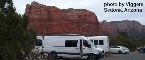
White Sprinter Van of the Week

Click here for the White Sprinter Van map of the world!!!
Road and Mountain Biking
We’re headed into a period of wet weather, so you probably want to ride Post right now. Or it might be too late already, because it’s going to rain this morning. This afternoon looks mostly dry, and your next chance for dry rounding around the area (with Post too wet to ride) is Friday. The HRATS have a work party on Sunday at Family Man at 9:30am.
Upcoming Events
There’s free meditation at Trinity Natural Medicine at 6:15am. There’s free yoga at 8am at Flow. That’s followed by $5Tai Chi at the Hood River Adult Center at 2:30, community yoga at 6pm at Samadhi in White Salmon, and free Tai Chi at Our Savior Church in Bingen at 6:30. At 7am on Friday, there’s the Kickstand Coffee Run, where jogging or walking 4 miles gets you a free cup of coffee and a donut.
Looking ahead to next weekend, Saturday is the annual Fred Meyer Fuchsia sale. CGWA has a work party and BBQ at Rowena Saturday. Saturday is also a potluck meal and garden party at Pacific Hermitage. The HRATS have a trail work party SUNDAY at Family Man at 9:30am. The Post Canyon is your Church.
Click here for the full events calendar.
Have an awesome day today!
Temira


