


Get the email free through the end of January – try it out! Click here.
Thank you for using this forecast. I offer it freely so you can have more fun and plan your life. It does take significant time and energy to produce. If you find yourself using it often, or if you feel your life is enhanced by this information, please make a donation. I count on your support to pay my bills, and am deeply grateful to you for choosing to help support me. You can get this forecast via email by donation. The email subscription isn’t $99/year. Not $50/year. Donating $12.34 or more gets you on the list for 12 months. Click on my photo to donate. Don’t PayPal? Send a check to Temira @ PO Box 841 in Hood River. Thank you for your support and thank you for trusting my forecast.
 |
4a-8a | 8a-12p | 12p-4p | 4p-8p | 8p-4a |
|---|---|---|---|---|---|
| Friday 10,000′ |
 |
|
|
|
|
| Saturday 10000′-7500′ |
 |
|
|
|
|
| Sunday 7500′->9000′->6000′ |
|
|
|
|
 |
Mt. Hood Snow Forecast
There’s not actually any snow at all in the Mt. Hood forecast for the next week. There is, however, some rain (enhanced by terrain, aka orographics) and plenty of sun and rainbows. For Friday, we’ll see intermittent rain and sunshine. The snow level will be 10,000′. About 1/3” rain falls by 4pm with another 1/10” rain overnight. Wind will be NW 40 early, WNW 50-55 (problematic for lifts) in the afternoon, and evening.
Saturday starts off with rain and wickedly windy weather. Fortunately, the wind will back off a bit by mid-morning. The snow level will be 10,000′ early. It will fall during the day and land at 7500′ after midnight. About 1/2” rain falls during the day. About 1/10” rain falls overnight. Wind will be WNW 60 early (for Meadows, that likely means no Star, MHX, Stadium, Cascade or Vista, for Skibowl, no Upper Bowl, and Timberline, well, I’m not sure, but you get the picture!). The wind will drop to WNW 45 mid-morning allowing most lifts to reopen. The wind will continue to fall, ending up at NW 25 overnight.
Sunday continues the rain-and-rainbows pattern. The snow level will be 7500′ early, 9000′ in the afternoon, and 6000′ overnight. About 1/4” rain falls with sunbreaks and rainbows during the day. Another .6” falls after 4pm, mostly early in the evening. Wind will be NW 25 early, @ 45 in the afternoon, and NW 35 overnight. On Monday, the snow level will be about 6000′ with a few scattered sprinkles and NW wind at 30ish. Tuesday looks similar. Looking long range, the weather looks quite warm and dry as we near the end of next week.
Random Morning Thoughts
We all want to be understood, right? One of the most effective ways to convey experience is to do so by naming our emotions. Why? Because emotions are universal across cultures – everyone feels them.
Unfortunately, our culture is one that doesn’t teach or encourage the sharing of emotions. Instead, we learn to talk about the content of a situation: “He did this to me… can you believe it???” Sharing content leaves the door open for misinterpretation of what we need.
I have a couple points to make. First, as a listener, you may find yourself getting angry or frustrated or feeling helpless in the face of such he-said-she-said storytelling. Your emotional response might just be what the storyteller was experiencing at the time. You can ask them: “So, you were feeling angry and frustrated and helpless?” That’ll deepen your conversation and let the person know you really understand them (secret: if you’re wrong, they’ll correct you!)
Second… um, well I forget what other point I was going to make. Perhaps it was something about noticing how you tell stories about your experiences. You’re more likely to get what you need (emotionally speaking), if you talk about your emotional experience – it’s generally easier for your listener to understand that experience. When you talk content, they have to interpret and filter through their experiences. More steps. More opportunity for confusion. Have fun with that. Have an awesome day.
Disclaimer required by my grad school program: I am not your therapist, but I am seeing clients at this time at Comprehensive Healthcare in White Salmon. In the meantime, I am your weather forecaster. Take everything I say with a grain of salt, and consult with your actual therapist about your mental health issues. One other thing: I plan to keep doing this forecast indefinitely. Forecasting and counseling are both deeply meaningful and nourishing to me.
Gorge Wind Forecast
For Friday, we’re starting off with a westerly gradient of .06 between Portland and The Dalles. The water temp is 39 degrees. Flow this morning was 241kcfs, very good for The Wall and Rufus. We’ll see light wind in the central Gorge until mid-afternoon with gusty westerlies at 18-23 west of Hood River and 10-13 east of Hood River. Mid-afternoon, the wind will pick up to 23-28 in the eastern Gorge and western Gorge, and likely near Hood River too.
Westerlies continue through Monday as high pressure sets up over the eastern Pacific. Saturday looks like 23-28 in the morning through the whole Gorge with 12-15 in the western Gorge in the afternoon and 22-25 east of The Dalles. Sunday starts with 10-13 everywhere. The wind will pick up to 15-18 in the western Gorge and 23-26 east of the Dalles. Monday currently looks like 21-24 between Stevenson and Mosier, but that could change as we get closer.
Gorge Weather Forecast
I just went outside, and it’s partly cloudy with stars and a moon. It’s also 52 degrees, and will end up at 54 today. Moderate west wind. 67% chance of rainbows. Saturday looks rainy in the morning and showery in the afternoon. Temps will be in the mid 40’s early and low 50s’ in the afternoon. Moderate westerlies. 99% chance of rainbows. Sunday looks showery. Temps will be in the upper 40’s eraly and low 50’s in the afternoon. Moderate westerlies. 99% chance of rainbows.
For weather specifically directed at travel through the Gorge, please visit Temira’s Awesome Travel Advisory Service on Facebook.
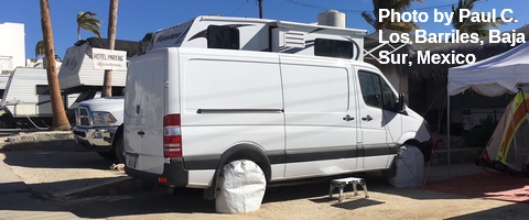
White Sprinter Van of the Week
Road and Mountain Biking
Post Canyon is currently closed to all users to protect the trails from damage. Hospital Hill is too wet to ride, and someone with the initials H.S. saw two cougars fighting in a tree along Jewett Creek on Monday. Whoopdee is closed to bikes and horses for the same reason. Syncline remains mobbed. I’m not sure about the upper half of Nestor, but the Horse Camp section is in good shape with one tree down.
Upcoming Events
Today at 7am, it’s the Kickstand Coffee Run. Jog or walk 4.1 miles and get a free cup of coffee and a donut. Tomorrow at 3pm is the Dirty Fingers Coldlap mixed surface ride. No drop. Includes mud.
Click here for the full events calendar.
Have an awesome day today!
Temira
