Support it with a contribution!

Thank you for using this forecast. Writing it takes 60-120 minutes a day; I can only keep it going with your generous financial support. Make a contribution or subscribe and get it in your inbox with bonus material. What’s that cost? Not $99 a year. Nope. Not $49. Contribute $19.99 or more, and you’re on the list for a year. People are added to this list on Thursday and Sunday. Thanks for your patience! Click below to contribute and keep the forecast going for everyone, nearly every day. Please include your email address in your contribution – PayPal/Venmo do not tell it to me!
Click here to use your PayPal
Venmo: @theGorgeismyGym
Snail Mail: Temira Lital, PO Box 841, Hood River, Oregon 97031
(note: I am not a non-profit entity. The only way to accept credit cards with a user-defined amount is to use the ‘donate’ button. Thanks for understanding!)
Auto-renewing subscription. New! Awesome!
The Forecast
| 4a-8a | 8a-12p | 12p-4p | 4p-8p | 8p-4a | |
|---|---|---|---|---|---|
| Wednesday 3500′->4000′->2500′ |
 |
|
 |
|
 |
| Thursday 2500′->4000′->1500′ |
 |
|
|
|
|
| Friday 1500′->6500′ |
 |
|
|
 |
 |
Mt. Hood Weather Forecast
One more round of snow is forecast for Mt. Hood before we move into a period of warmer weather and then some rain. Hey, it’s spring. It’s about time rain showed up for the slopes. Models still don’t agree on how much rain, but they do agree on warm-enough temps.
Wednesday, however, will be sunny for the morning, at least. Instability creates some little fluffy clouds midday, and high clouds move in during the evening. The free air freezing level will be around 2000′ this morning, 4500′ this afternoon, and back to 2500′ overnight. Wind: SW 10-15 during the day builds to SW 15-30 in the evening and WSW 20-25 overnight.
Snow starts flying around dawn on Thursday and continues into the night. The snow level will be 2500′ in the morning, 4000′ in the afternoon, 2000′ in the evening, and 1500′ overnight, by which time the precip should have stopped. About 0.3” water equivalent (WE) is forecast during the day. Another 0.3” WE is forecast overnight, Total snow: about 6”. It’ll come in light, then dense, then light and fluffy again for the final few inches. Wind: WSW 20-25 in the morning, SW 30-50 mid-afternoon, W 30 in the evening, and W 20 overnight.
Friday may have a few flurries, then sun, then high clouds, then snow-switching-to-rain. The snow level will rise from 1500′ in the morning to 6500′ in the evening. As of this morning, models are suggesting anything from 0.5” to 1.5” rain for the slopes. Hopefully they’ll settle done some as we get closer. Temps stay mild through Sunday evening and drop cold enough for snow to start next week.
Note on wind speeds. Different wind directions are experienced in different ways on Mt. Hood. For example, west wind at 50mph will hit the slopes and exposed ridges at W 50. SW 50 may hit the ridges at SW 50, but will likely only be SW 20 below tree line. Hence the ranges for wind. Depends where you are on the mountain. Hopefully that helps clarify.
Gorge Wind Forecast
Wind isn’t the primary thing happening in the forecast for the next few days. Nope. It’s more about the continuation of unseasonable precipitation. A series of low pressure systems exerts influence over the PNW for at least the next week; this keeps the wind gusty, unreliable, and of moderate strength.
Wednesday starts out with light and variable wind and light westerly gradients. By late morning, westerlies pick up to 7-10 or so from Stevenson to Rufus, perhaps to Arlington. An approaching (strong) cold front nudges the wind up to gusty 16-20 from Stevenson to Rufus from 2pm or so on into the evening. River flow is 153kcfs, river temp is 52F, and high temp forecast is 63F.
Thursday might be cloudy to start, but it quickly turns quite wet. The wind will be calm through 2pm. If you head out east of The Dalles, you might find rainy, gusty 15-18mph wind after 2pm or so. West of The Dalles, the wind picks up to W 7-10 in the evening. High temp: unseasonable cool at 54F.
Friday will be dry, cloudy, and not really windy at all. Some drizzle arrives early evening and brings westerlies at 5mph or so. High temp: 59F. Light westerlies are forecast for Saturday. Slightly stronger, but very gusty, westerlies could show up on Sunday, but quality will be low. La Nina: great for the snowpack, not so great for wind.
Coast, Jones, Coast
Done until spring, unless there’s an obvious Coast or Sauvie’s or Jones day.
Hood River Weather Forecast
Clear sky this morning turns partly cloudy this afternoon and overcast tonight. Temps will be in the low 40’s early and low 60’s later. Light westerlies most of the day. Moderate in afternoon and evening. No rainbows. Thursday will be rainy all day with the heaviest rain between 11am and 5pm. Temps will be in the upper 30’s early and mid 50’s later. Calm wind until early evening. Then light westerlies. 56% chance of rainbows. Friday will be mostly cloudy, then high overcast, then drizzly from early evening on. Temps will be in the upper 40’s early and upper 50’s later. Calm wind. 12% chance of rainbows.
Looking for a complete Columbia Gorge forecast? Looking for more humor in your weather? Obscenities? You’re looking for my TATAS: Temira’s Awesome Travel Advisory Service on Facebook.
Cycling
A good portion of the Eldorado Trail (below the intersection with Riorden Hills Road (near the top, below the clearcut) is closed starting today for approximately 10 days due to nearby timber harvest. Do not enter that area for your safety. Also, Post is too wet too ride right now, so just don’t! Courtney Road (the road that goes up above Syncline) is closed until October. Do not attempt to use it to access trails. Starting this summer, you will need a parking pass to park at Post Canyon. This money will support trails. Speaking of trails… it’s too muddy to ride them right now, and it will stay that way for a while. If you ride wet, sloppy trails, you will do significant and potentially permanent damage. Please don’t. Hospital Hill: cows are out – no dogs allowed. Underwood: do not enter areas that are closed due to logging operations. Recommendation: ride gravel roads and pavement for a while until the trail systems dry out.
Local Events
Please let me know about events. I often only hear about them if you folx let me know!
This weekend is the Stevenson to Carson Ridge Run. Ferment’s Tuesday night 4-mile walk/run is at 6pm. At 7:15am on Wednesdays, there’s a run from the White Salmon Bakery. At 7am on Friday morning, you can get a donut and coffee for going for a run at Kickstand Coffee. The Small Boat paddlers have a group paddle on Sunday at 11am at the Event Site. The Dirty Fingers Sunday Service rides happens at 9am – this week is the last one. They are fast-paced. If you are not, bring a buddy. The ride is followed by bike race viewing and beer drinking at the shop. Post and Pint happens Thursday evenings at 5:30 when Post is not too wet to ride.
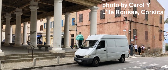
Sprinter Van of the Week!
 Click here for the Sprinter Van map of the world!!!
Have an awesome day!