It’s snowing up there on Ye Olde Volcano this morning, with a bit of a breeze to pile the snow into shred-friendly stashes. You can expect continued orographic flurries all day today, increasing this afternoon. The snow level will be 2500′ this morning and 3500′ this afternoon. Models don’t predict much accumulation, but let’s go with 1-2” of new today. Wind will be WNW 30 all day long. Continued after the chart.
 |
4a-8a | 8a-12p | 12p-4p | 4p-8p | 8p-4a |
|---|---|---|---|---|---|
| Today 2500′-> 3500′ |
 |
 |
 |
 |
 |
| Tomorrow 5000′ |
 |
 |
 |
 |
 |
| The next day 5000′-> 2000′ |
 |
 |
 |
 |
 |
Mt. Hood Snow Forecast, continued…
Wednesday starts out with some high clouds, and alternates between high clouds and clear sky until the evening, when clouds move in. Snow starts up around 8pm and continues through Thursday morning. The sounding model says the snow level will be 5000′ all day. However, the 850mb model suggests 6000′. Along with that variance, we’re expecting .5-.7” water value. Hmm… let’s call it 3-4” of dense new snow for now. Wind Wednesday will be WNW 20 for much of the day, turning to WSW 15 in the evening.

Donate and keep the forecasts coming
See below for details.
Thursday starts off with orographic snow showers and strong wind, and stays that way all day long. The snow level will be 5000′ early, dropping to 2000′ in the afternoon. We’ll see .3” WV during the day, for 3” of new, followed by another .3” WV overnight, for another 3” of new. Wind will be WSW 40 early, turning to WNW 30-35 after noon and staying that way through the evening.
Friday currently looks windy and snowy with the snow level around 3000′.
Support your forecaster, Temira!

Thank you for using this forecast. Does it save you time, gas money, or help you have more fun in your life? Make a donation! Get your forecast here for free or donate and get on the mailing list for year-round wind forecasts and ski season snow forecasts. Just click on my photo to donate via PayPal or credit card. The email isn’t $99/year. Not $50/year. No, just $12.34 or more gets you on the list for 12 months, and sometimes there are cool prizes. Don’t PayPal? Send a check to Temira @ PO Box 841 in Hood River. Thank you for your support, and thank you for trusting my forecast.
Gorge Wind Forecast
Tuesday is starting out with westerlies at 12-15 through the entire Gorge. That westerly flow is the result of west gradients at .05 (pdx-dls) and .08 (dls-psc). Expect the west wind to pick up to 25-29 from Mosier to Arlington by 10am or so, continuing through the early evening. The Viento-HR stretch is a bit of a wild card. If it remains under the clouds, the wind will stay at gusty 12-15. If the sun comes out, low to mid 20’s is a better bet.
Wednesday starts off with 12-15 pretty much everywhere, fading to 5-10 after noon. Thursday’s still looking like a Classic Gorge Setup, with high pressure off the coast and low pressure in the desert. That will result in relatively steady westerlies at 25-29 from Mosier to Arlington, pretty much all day. Once again, areas west of Mosier will be a crapshoot, dependent on the cloudline. Looking ahead to the weekend, Sunday (really way too far out to be predicting) looks like another Classic Gorge Setup.
Random Morning Thoughts
This section of the report is on spring break, enjoying play time in the Gorge. =)
Disclaimer required by my grad school program: I am not your therapist. I am your weather forecaster. Take everything I say with a grain of salt, and consult with your actual therapist about your mental health issues.
Gorge Weather Forecast
I stepped outside to check the sky coverage this morning, and it was starless with just a splotch of lighter darkness to the east. Let’s call this a cloudy start in Hood River. We’ll see partly to mostly cloudy sky today with occasional showers, especially early in the morning and late in the afternoon. Temps will be in the mid 40’s early and the low 50’s in the afternoon. Light wind early, moderate to strong west wind after 10am. 97.2% chance of rainbows.
Wednesday looks partly cloudy with a slight chance of a few sprinkles. Real rain moves in after 10pm. Temps will be in the low 40’s early and the upper 50’s in the afternoon. Light wind. 8% chance of rainbows. Thursday starts off showery and becomes less showery in the afternoon. Temps will be in the low 40’s early and the mid 50’s in the afternoon. Strong west wind. 73% chance of rainbows.
For weather specifically directed at travel through the Gorge, please visit Temira’s Awesome Travel Advisory Service on Facebook.
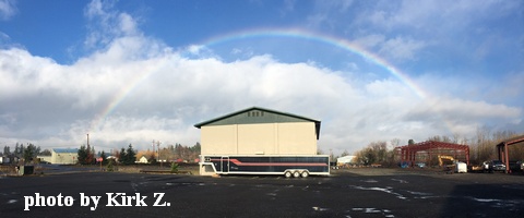
White Sprinter Van of the Day

Road and Mountain Biking
I took a short lap at Syncline yesterday, and the dirt was just fine. That’s the place to be again today, but earlier will be better because the west wind will kick in after 10am. I suspect Post will be a bit muddy or at least a bit stick this morning, but perhaps by this afternoon? Our on the roads, you’re going to find pretty strong west wind today. Tomorrow looks much less breezy. In other bike news, the Gorge Roubaix race the weekend of April 3rd is still looking for volunteers. Sign up and help keep a good thing going.
Upcoming Events
Today is Tuesday. There’s community yoga at Flow at 4:30pm, pickup touch rugby at 5pm at the ballfields next to Jackson Park, $12 prime rib at Cebu from 5pm to 9pm, and my personal favorite: community meditation with the monks from Pacific Hermitage at Yoga Samadhi at 6:30pm.
Have an awesome day today!
Temira
The Clymb: free membership.
Cheap gear.
Temira approves. Click to join.
