Mt. Hood Snow Forecast
This is definitely the easiest part of my forecast today. It’s going to be snowy on Mt. Hood all day today. The snow level is a little tricky due to warm air in the west and up high and cold air in the east, but the snow will ski like it’s about a 4000′ snow level in the morning and 2000′ in the afternoon. We’ll see .2-.3” water value (WV) between this morning and 4pm, for 2-3” of snow. We’ll see another .3-.4” between 4pm and 4am, for another 3-5” of new. Wind today will be W 25 early and WSW/W 35-40 in the afternoon and evening. Continued after the chart…
 |
4a-8a | 8a-12p | 12p-4p | 4p-8p | 8p-4a |
|---|---|---|---|---|---|
| Saturday 4000′->2000′ |
 |
|
|
|
|
| Sunday 2000′->1000′ |
 |
|
|
|
|
| Monday 1000′->0′ |
 |
|
|
|
|
Mt. Hood Snow Forecast, continued…
Chains are required for your drive, and I-84 eastbound was closed as of the time of this forecast. SR-14 was open, but it’s probably a bad idea given all the freezing rain in the western Gorge and the snow in the Hood River area – 14” at my house at 300′.
Moving on to Sunday, it looks like a very snowy day. The snow level will be 2000′ in the morning and less than 1000′ after midnight. We’ll see 1.1” WV between 4am and 4pm for 12-14” of new snow. We’ll see another .5” between 4pm and 4am, for 5-7” of new. Wind will be WSW 35 early and W 40 in the afternoon, dropping to WNW 30 after midnight. Skibowl is open for night skiing on Sunday. Meadows is not.

Say “thanks for the forecasts”
by making a donation!
Keep the forecasts coming.
Does this forecast save you time, gas money, or help you have more fun in your life? Make a donation to support continued forecasting, and get the forecast in your inbox each day. Click on the button to donate. The email subscription isn’t $99/year. Not $50/year. No, just $12.34 or more gets you on the list for 12 months. Don’t PayPal? Send a check to Temira @ PO Box 841 in Hood River. Thank you for your support and thank you for trusting my forecast.

Mt. Hood Snow Forecast, finished
Monday brings light orographic snow flurries and sunbreaks with the heaviest snowfall before noon. The snow level will be less than 1000′ early, dropping to sea level in the afternoon with temps crashing into the low double digits on Mt. Hood. We’ll see trace amounts of new snow or maybe a couple inches. Wind will be WNW 30 early, becoming W 15 in the afternoon.
Tuesday might bring a few flurries, but should be mostly sunny. The free air freezing level will be at sea level with temps on Mt. Hood in the low double digits. Wind will be out of the SE at 5 in the morning and 20 in the afternoon. We may or may not see snow on Wednesday and Thursday, but it will certainly be very cold on the hill through the end of the week. That should keep the snow in great shape.
Simcoe Accounting
Simcoe Accounting, LLC is a full-service accounting firm. Serving clients throughout the Columbia gorge, dedicated to providing our clients with professional, personalized services and guidance in a wide range of accounting and business needs. We believe in getting it right the first time. The right service at the right time, at the right price. Contact us for a free quote by clicking the headline above.
Gorge Wind Forecast
The Gorge wind forecast is really tricky today will all this cold air trapped all over the place. At 5am, the gradient was E .06, and it’s not going to switch to west until an upper level low off the coast moves onto Vancouver Island. I’m guessing we’ll see a switch to west wind in Hood River around 10pm, although models predict it’ll happen sooner. Anyway, models think we’ll be at W 7-10 Sunday morning and 23-26 in the eastern Gorge on Sunday afternoon with W 13-16 in the western Gorge. Monday looks like W 7-10 early and E 20-25 in the afternoon. We’ll see E 40 on Tuesday.
Jones, Sauvie’s, Coast Beta Test Forecast
If you click right here , you’ll find NOAA’s coast forecast.
Random Morning Thoughts
It’s getting late, relatively speaking, and I don’t feel like philosophizing today. I feel like playing in the snow. Sledding, snowboarding 7th Street, and skiing the hills. Hooray! Have an awesome day!
Disclaimer required by my grad school program: I am not your therapist (but I could be 51 graduate school credits from now). I am your weather forecaster. Take everything I say with a grain of salt, and consult with your actual therapist about your mental health issues. One other thing: I plan to keep doing this forecast indefinitely, even when I am a therapist.
Gorge Weather Forecast
I was thinking we’d see a switch to freezing rain last night, but there’s so much cold air that we just stayed snow. I really don’t know what the F is going to happen, and neither does anyone else, so I’ll just guess. My best guess is we’ll see a switch to west wind between 10pm and 1am tonight, and I’ll base everything else on that.
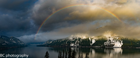
So, light snowfall this morning followed by light freezing rain after 1pm, continuing through 1am, after which we’ll see light rain. Maybe. Temps will be in the low 20’s this morning, maybe just maybe rising to the low 30’s after midnight. No rainbows. Sunday looks cold and rainy with a chance of freezing rain or snow after midnight, but most likely just cold rain. Temps will be in the mid 30’s all day. Let’s hope that’s right, because we’ll get a LOT of ice if it’s not above freezing. Light west wind. 76% chance of rainbows.
Monday starts off with clouds and light rain and then gets cold with The Nothing. Expect icy roads to pop up midday Monday. Temps will be in the mid 30’s early and the low 30’s in the afternoon (NWS says a high of 41, but I’m not buying it). West wind early, east wind later. 14% chance of rainbows.
For weather specifically directed at travel through the Gorge, please visit Temira’s Awesome Travel Advisory Service on Facebook.
White Sprinter Van of the Day
Road and Mountain Biking
You can ride your bike if you have a fat bike. =)
Upcoming Events
I believe all the hills in the Gorge are open for skiing today. Please ski and ride with a partner. Wear a helmet. You could also go sledding somewhere crazy like 7th Street or Binn’s Hill. Again, wear a helmet.
Have an awesome day today!
Temira